Log inSign up
USGS Arizona
US Department of the Interior
2,510 posts
Image
user avatar
USGS Arizona
US Department of the Interior
@USGSAZ
USGS science from the southwest US & beyond. Follow us for science news, new publications, and USGS-related activities. Tweets do not = endorsement.
Southwest U.S.
Joined June 2014
162
Following
2,214
Followers
RepliesRepliesMediaMedia

New to X?

Sign up now to get your own personalized timeline!

Create account

By signing up, you agree to the Terms of Service and Privacy Policy, including Cookie Use.

Terms·Privacy·Cookies·Accessibility·Ads Info·© 2026 X Corp.
Don't miss what's happening
People on X are the first to know.
Log inSign up
  • user avatar
    USGS Arizona
    US Department of the Interior
    @USGSAZ
    Jul 4
    Happy Fourth of July! Did you know that Arizona is home to a unique population of desert-nesting bald eagles? While many people associate these iconic birds with the dense forests of the Pacific Northwest or Alaska, they also thrive along Arizona's desert rivers and reservoirs.
    Image
    198
  • user avatar
    USGS Arizona
    US Department of the Interior
    @USGSAZ
    Jun 30
    Happy Asteroid Day!
    user avatar
    USGS Astrogeology
    US Department of the Interior
    @USGS_AstroGeo
    Jun 30
    Ready to rock your world? Asteroid Day lands June 30! ☄️ Asteroid Day is a day of global awareness of asteroids and planetary defense, held annually on the anniversary of the Tunguska impact event in 1908. USGS Astrogeology plays a critical role in planetary defense and
    Several hikers in the foreground descending into the bowl of Meteor Crater with rock layers exposed on the opposite crater wall
    Image
    139
  • user avatar
    USGS Arizona
    US Department of the Interior
    @USGSAZ
    Jun 30
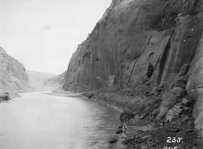
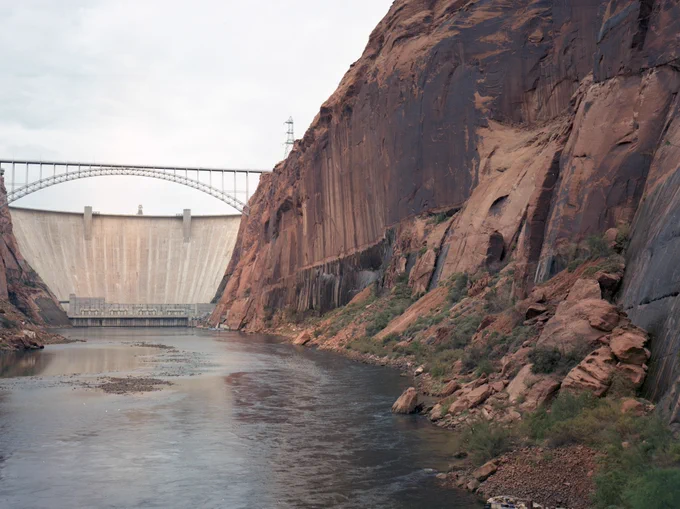
    On the morning of December 23, 1889, photographer Franklin Nims stepped onto a gravel bar at a slight bend in the Colorado River and took this photograph. Nims was the photographer for the Stanton Expedition, a survey led by railroad engineer Robert Brewster Stanton to determine
    Wide river flowing through steep rocky canyon walls with small boats docked along the shore at the base of the cliffs. 1889 Nims (Stanton Expedition)
    Large concrete dam spanning a river between steep rocky cliffs under a cloudy sky. 1992 USGS.
    A large concrete dam spans a river between steep rocky cliffs under a clear blue sky. 2011 Webb (USGS).
    642
  • USGS Arizona reposted
    user avatar
    USGS Water Resources
    US Department of the Interior
    @USGS_Water
    Jun 30
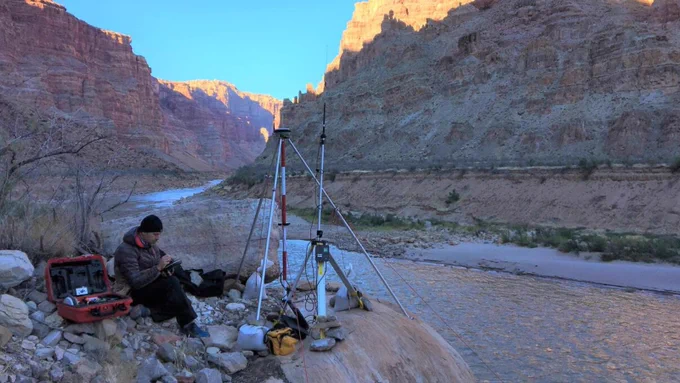
    40 million people. 7 states. 1 river. From John Wesley Powell’s first expedition to today’s satellite telemetry, USGS science on the Colorado River is as grand as the Grand Canyon. USGS plays a vital role in monitoring the Colorado River, providing reliable scientific data
    Grand Canyon survey party at Lees Ferry in 1923. USGS photo
    Scientists conduct research on Lake Mead.
    Advanced UAS science improves the accuracy, efficiency, and safety of data collection in challenging environments.
    Setting up the RTK GPS base station above the Colorado River, downstream of the rapids of Cataract Canyon. Photo by Chris Wilkowske, USGS
    451
  • USGS Arizona reposted
    user avatar
    USGS Water Resources
    US Department of the Interior
    @USGS_Water
    Jun 30
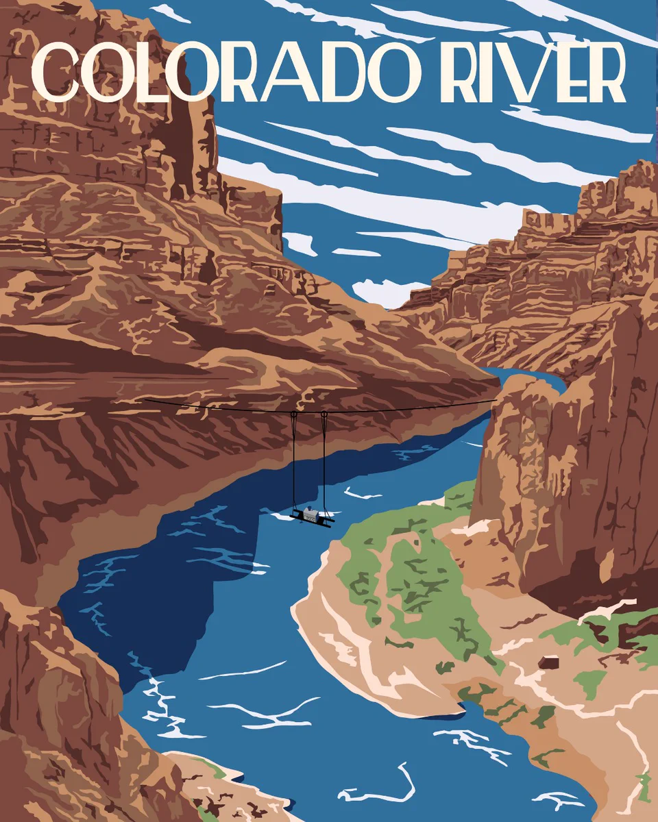
    Great American Waterway Day 2: The Colorado River! 🇺🇸 From the Rockies to the Gulf of California, the Colorado River is a lifeline for nearly 40 million people across the U.S. and Mexico. It supports major cities, farms, ecosystems, recreation, and hydropower across it’s
    Vintage-style poster of the Colorado River with a USGS water quality monitor portrayed on pulleys across the canyon. Illustration by Althea A. Archer, USGS
    367
  • user avatar
    USGS Arizona
    US Department of the Interior
    @USGSAZ
    Jun 25
    Before there were photo filters, there was just... waiting a century to take the exact same picture. By standing in the exact footsteps of photographers from the early 1900s, researchers can document exactly how landscapes change over time. The Southwest Repeat Photography
    Image
    583
  • user avatar
    USGS Arizona
    US Department of the Interior
    @USGSAZ
    Jun 23
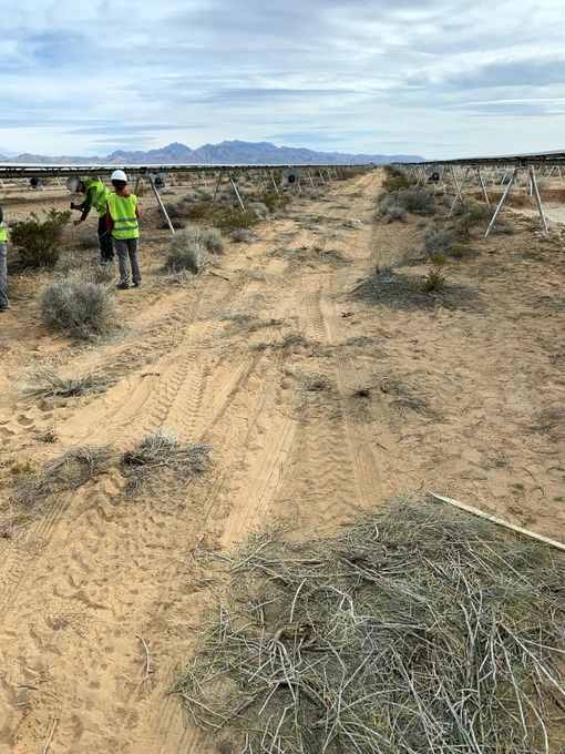
    How do you build a solar facility without disturbing soil and creating dusty conditions? 💨☀️ Building solar facilities in the desert requires installing panels and infrastructure, but the way that construction is implemented can affect how much wind erosion occurs. Dust
    Image
    Image
    515
  • user avatar
    USGS Arizona
    US Department of the Interior
    @USGSAZ
    Jun 22
    Check out this new fact sheet on USGS science at Lees Ferry from the Arizona Water Science Center! 🌊🙌📏
    user avatar
    USGS Water Resources
    US Department of the Interior
    @USGS_Water
    Jun 19
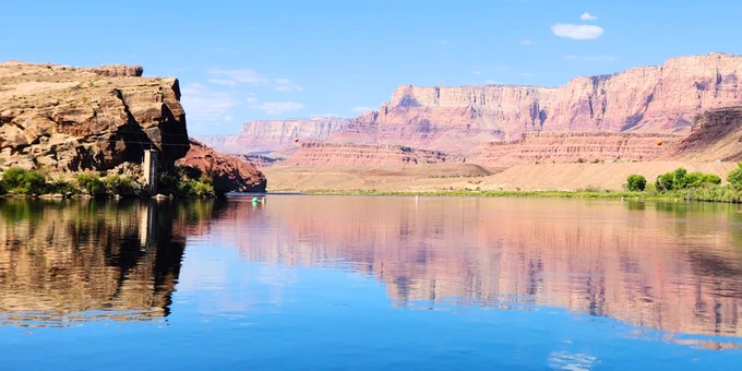
    100+ years of water data. One iconic location 📍📈 Located at the gateway to the Grand Canyon, the Colorado River at Lees Ferry is where recreation meets resource management and vital aquatic science. In 1921, the USGS established a streamgage at this location to monitor the
    he Colorado River at Lees Ferry. The Lees Ferry streamgage is visible at the base of the cliffs on the left sides of the photo. Photo by the USGS
    AZWSC staff, Sarah Shepherd and Kat Cooney, collect a discrete water-quality sample for NWQN.
    Hydrologic technician, Janice Talley, services the continuous water-quality buoy.
    Hydrologic technician, Decker Mcelroy, collects discharge data using an ADCP.
    286
  • user avatar
    USGS Arizona
    US Department of the Interior
    @USGSAZ
    Jun 18
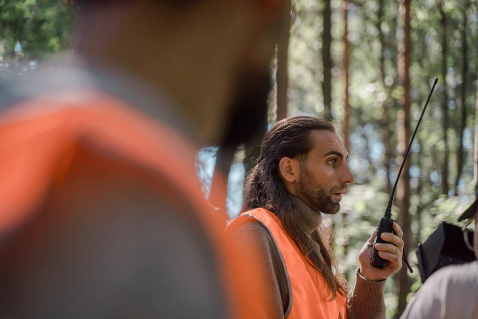
    How can public scientific research better serve the precise needs of local communities and decision-makers? Research designed for a generic or non-specific management group frequently misses the desk of the people who need it most. Tailoring data to a single or even hypothetical
    Men in high-visibility vests communicate using walkie-talkies in a forest setting. Public domain.
    84
  • user avatar
    USGS Arizona
    US Department of the Interior
    @USGSAZ
    Jun 16
    Invasive grasses are changing fire patterns and how we manage them in the Intermountain West, USA. Researchers Sarah Costanzo and Seth Munson conducted a systematic review and meta-analysis of 204 scientific articles published between 1985 and 2023. The study focused on six
    Image
    230
  • USGS Arizona reposted
    user avatar
    USGS Water Resources
    US Department of the Interior
    @USGS_Water
    Jun 16
    Thinking of trading your screen time for stream time? Don’t forget to "pack" your data! 🚣🌊 The USGS operates a network of more than 13,000 streamgages nationwide. Whether you’re looking for the perfect rapids or a peaceful float, our real-time data tells you if conditions
    A group of people wearing helmets and life jackets paddle a whitewater raft through a strong current on the Gauley River in West Virginia. In the background, another group of people sits on a large rock, watching the raft navigate the rapids. Photo by Matt Kearns, USGS
    215
  • user avatar
    USGS Arizona
    US Department of the Interior
    @USGSAZ
    Jun 12
    The USGS Flagstaff Science Campus in northern Arizona was honored to host USGS Director Dr. Ned Mamula for two days in early June. The visiting group included the Senior Advisor to the Director, the Acting Deputy Director, Southwest Regional Directors, and the Acting Chief of
    Image
    Image
    Image
    Image
    113
  • user avatar
    USGS Arizona
    US Department of the Interior
    @USGSAZ
    Jun 11
    USGS scientists have mapped a continuous profile of the Colorado River in Grand Canyon’s riverbed and water surface, and it was long overdue. In 1923, surveyors first mapped the water surface profile of the Colorado River. This was before the construction of Hoover Dam (1935)
    Image
    Image
    105
  • user avatar
    USGS Arizona
    US Department of the Interior
    @USGSAZ
    Jun 9
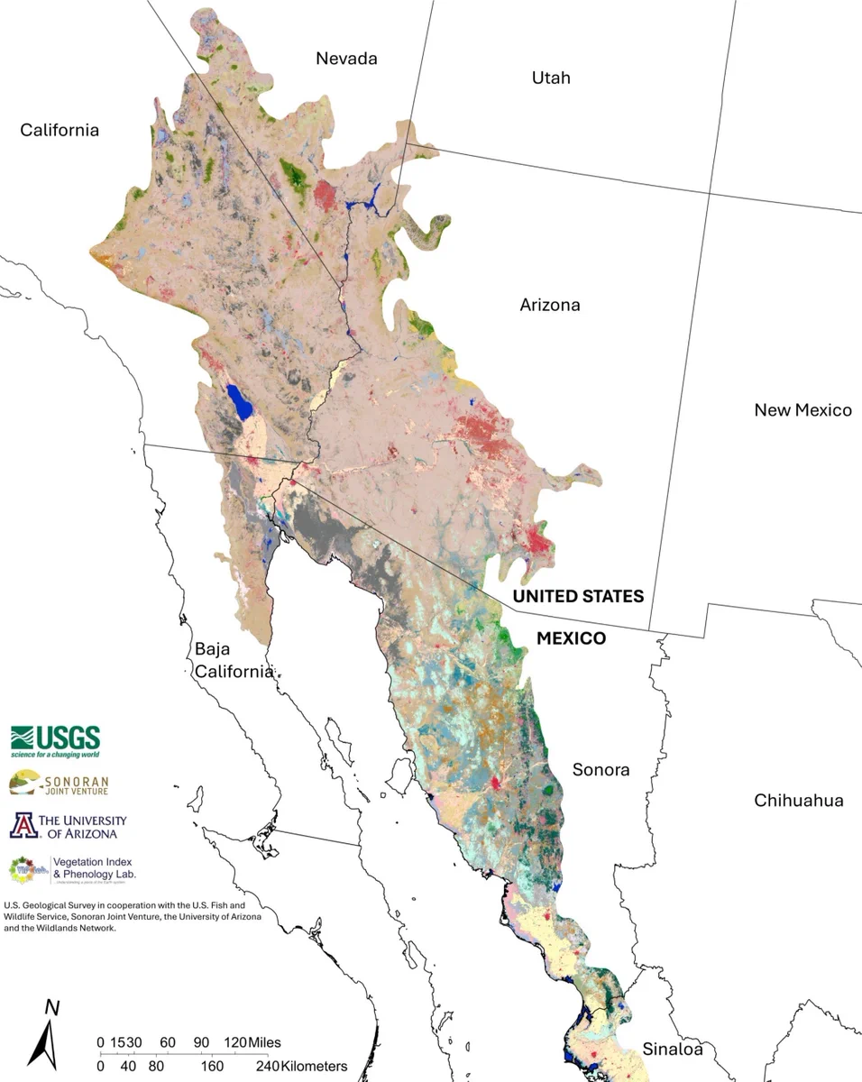
    The Sonoran and Mojave Deserts are incredibly diverse, serving as habitat for migratory birds and wildlife. USGS researchers and our partners combined satellite data, decadal plant growth cycles, and extensive ground verifications to map nearly 148 million acres at a sharp
    Image
    17K
Advertisement
Advertisement