Log inSign up
USGS Water Resources
US Department of the Interior
5,475 posts
Image
user avatar
USGS Water Resources
US Department of the Interior
@USGS_Water
Observing, understanding, predicting, delivering #WaterScience 💧Comment policy: usgs.gov/comments 💧Posts do not=endorsements on.doi.gov/pgwu0Y
usgs.gov/mission-areas/…
Joined April 2016
60
Following
8,030
Followers
RepliesRepliesMediaMedia

New to X?

Sign up now to get your own personalized timeline!

Create account

By signing up, you agree to the Terms of Service and Privacy Policy, including Cookie Use.

Terms·Privacy·Cookies·Accessibility·Ads Info·© 2026 X Corp.
Don't miss what's happening
People on X are the first to know.
Log inSign up
  • user avatar
    USGS Water Resources
    US Department of the Interior
    @USGS_Water
    Jul 10
    USGS science is worth its weight in salt! 🧂 Measuring streamflow in shallow, rocky, or highly turbulent channels can pose a unique challenge where mid-section, ADCP, flume, and volumetric measurement techniques are not practical. To address this challenge, USGS scientists
    Image
    419
  • user avatar
    USGS Water Resources
    US Department of the Interior
    @USGS_Water
    Jul 8
    June streamflow conditions across the U.S. 💧 In June, wet conditions hit portions of the Midwest and Central U.S., while dry conditions expanded across portions of the Mid-Atlantic, Southeast, and Northeast. Notable weather patterns included: 🌧️ Frequent rainfall maintained
    June 2026 streamflow conditions for the U.S.
    313
  • user avatar
    USGS Water Resources
    US Department of the Interior
    @USGS_Water
    Jul 7
    National water availability data at your fingertips! 💧🎉 The National Water Availability Assessment Data Companion provides regularly updated, model-based estimates of water availability and use on a national scale. Nearly 27 million Americans, or 8% of the U.S. population,
    View of soil moisture data for January 2020 across the lower 48 United States from the Data Companion web mapper.
    4.6K
  • user avatar
    USGS Water Resources
    US Department of the Interior
    @USGS_Water
    Jul 4
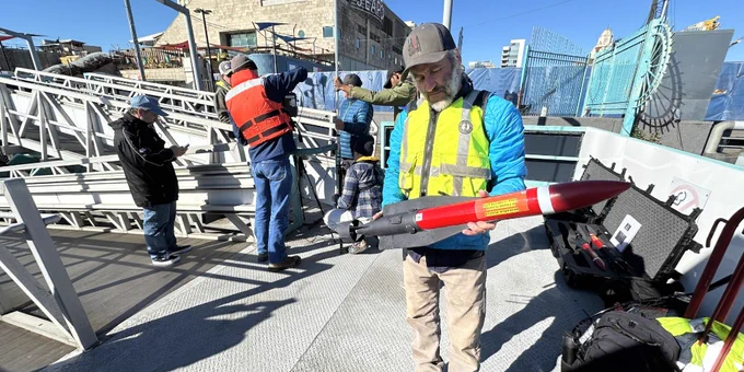
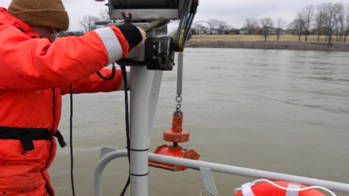
    In 1776, George Washington’s troops braved an icy Delaware River. Today, unmanned robotic vehicles are diving beneath those same waters. ❄️🤖 The Delaware River Basin (DRB), the first regional pilot watershed for the USGS Next Generation Water Observing System (NGWOS), is a
    Retrieval of an NGWOS EcoMapper in the Delaware River at Fort Mifflin. Photo by Nickolas Grim
    Deploying an AUV into the Delaware River. USGS photo
    An aerial view of hydrologic technicians on a truss bridge above Brandywine Creek measuring streamflow with an ADCP. Photo by Nick Giro and Chris Lewis, USGS
    USGS scientist holding an AUV. USGS photo
    383
  • user avatar
    USGS Water Resources
    US Department of the Interior
    @USGS_Water
    Jul 4
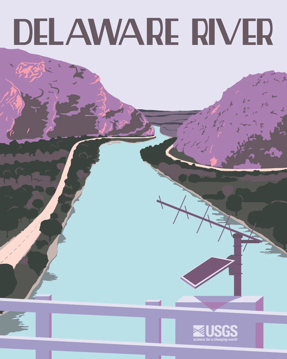
    Great American Waterway Finale: The Delaware River! 🇺🇸✨ Spanning a 13,500‑square‑mile basin, the Delaware River supplies drinking water to more than 15 million people and supports rich ecosystems, fisheries, navigation, and regional industry. Its waters fueled early American
    Vintage-style poster of the Delaware River near the Delaware Water Gap with a USGS gage on the bridge in the foreground. Illustration by Althea A. Archer, USGS
    321
  • user avatar
    USGS Water Resources
    US Department of the Interior
    @USGS_Water
    Jul 3
    🌊 From the Appalachian headwaters to the Atlantic coast, everything is connected. 🦀 Spanning 64,000 square miles across six states and the District of Columbia, the Chesapeake Bay is the nation’s largest estuary. Its watershed connects more than 20 million people, thousands
    A hydrologic technician uses a cableway to collect a water-quality sample from the Choptank River on Maryland's Eastern Shore in Greensboro. Photo by David Fisher, DOI
    A hydrologic technician surveys Georges Creek near Westernport Maryland as part of a survey for high water marks following severe flooding in the area in May 2025. Photo by David Fisher, DOI
    Dr. Heather Walsh holds a blue catfish as part of sampling to determine PFAS levels in the fish. USGS photo
    A USGS physical scientist assesses a streambank riparian zone in Orson, Pennsylvania. Photo by Neel Hodgkinson, USGS Contractor
    320
  • user avatar
    USGS Water Resources
    US Department of the Interior
    @USGS_Water
    Jul 3
    Great American Waterway Day 5: The Chesapeake Bay! 🇺🇸 The nation’s largest estuary, the Chesapeake Bay is shaped by a vast watershed and supports one of the most productive ecosystems in the world. Its wetlands, tidal marshes, and oyster reefs filter water, protect coastlines,
    Image
    225
  • user avatar
    USGS Water Resources
    US Department of the Interior
    @USGS_Water
    Jul 2
    Decoding America's longest river: Inside USGS science on the Mississippi River 🌊 USGS work on the Mississippi River supports flood management, safe navigation, and water quality. From microscopic strands of invisible DNA to thousands of tons of sediment, the Mississippi is a
    Gateway to the West Arch, St Louis, MO from the Mississippi River. Photo by USGS
    USGS scientists collect sediment and water-quality samples on the Mississippi River above Vicksburg. Photo by Shannon Williams, USGS
    Preparing for a discharge measurement on the Mississippi River near Memphis, TN. Photo by Jerry Garrett, USGS
    Sediment sampling on the Mississippi River in Arkansas, Photo by USGS
    216
  • user avatar
    USGS Water Resources
    US Department of the Interior
    @USGS_Water
    Jul 2
    Great American Waterway Day 4: The Mississippi River! 🇺🇸 Running more than 2,300 miles to the Gulf of Mexico, the Mississippi is one of North America’s most iconic rivers and the backbone of the nation’s river transport network. The Mississippi drains 41% of the continental
    Vintage-style poster of St. Anthony Falls on the Mississippi River showing a streamgage in the foreground. Illustration by Althea A. Archer, USGS
    304
  • user avatar
    USGS Water Resources
    US Department of the Interior
    @USGS_Water
    Jul 1
    Welcome to the Great Lakes! Imagine a single network of lakes holding over 20% of Earth's fresh surface water, framing thousands of miles of coastline, and supporting 40 million people in the U.S. and Canada. From Lake Superior to Lake Ontario, here’s a look at how USGS
    Filtering water samples through an eDNA backpack while sampling on Lake Huron. Photo by Jessica Oswald, USGS-GLSC
    Using a peristaltic pump to filter lake water before pouring it into bottles to be sent off for nutrient analysis. Photo by Leslie Reyes, USGS Contracto
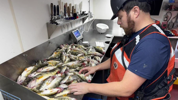
    Examining the catch from waters around Goderich, Ontario during a Lake Huron fall prey fish survey. Photo by Kristy Phillips, USGS
    A Saildrone uncrewed surface vehicle and the USGS research vessel Kiyi at the 2022 Ashland, Wisconsin, launch event to kick off a month-long mission in western Lake Superior. Photo by Andrea Miehls, USGS
    206
  • user avatar
    USGS Water Resources
    US Department of the Interior
    @USGS_Water
    Jul 1
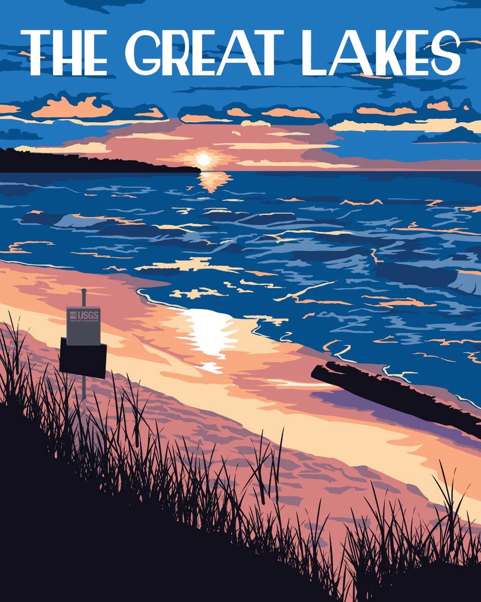
    Great American Waterway Day 3: The Great Lakes! 🇺🇸 Superior, Michigan, Huron, Erie, and Ontario are Great Lakes indeed! Together, they make up the world’s largest freshwater system, supplying drinking water, transportation routes, recreation, and economic power for millions.
    Vintage-style poster of a Great Lake during sunset with a USGS streamgage in the foreground on the shore. Illustration by Althea A. Archer, USGS
    232
  • USGS Water Resources reposted
    user avatar
    USGS Arizona
    US Department of the Interior
    @USGSAZ
    Jun 30
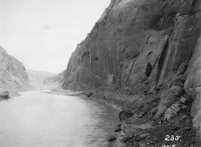
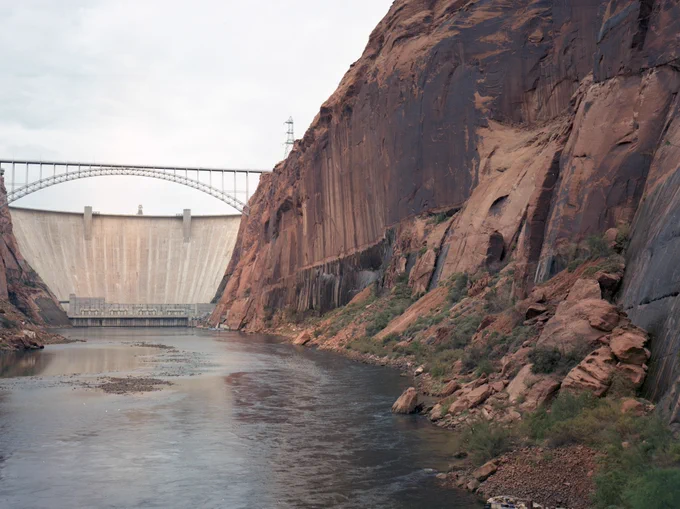
    On the morning of December 23, 1889, photographer Franklin Nims stepped onto a gravel bar at a slight bend in the Colorado River and took this photograph. Nims was the photographer for the Stanton Expedition, a survey led by railroad engineer Robert Brewster Stanton to determine
    Wide river flowing through steep rocky canyon walls with small boats docked along the shore at the base of the cliffs. 1889 Nims (Stanton Expedition)
    Large concrete dam spanning a river between steep rocky cliffs under a cloudy sky. 1992 USGS.
    A large concrete dam spans a river between steep rocky cliffs under a clear blue sky. 2011 Webb (USGS).
    642
  • user avatar
    USGS Water Resources
    US Department of the Interior
    @USGS_Water
    Jun 30
    40 million people. 7 states. 1 river. From John Wesley Powell’s first expedition to today’s satellite telemetry, USGS science on the Colorado River is as grand as the Grand Canyon. USGS plays a vital role in monitoring the Colorado River, providing reliable scientific data
    Grand Canyon survey party at Lees Ferry in 1923. USGS photo
    Scientists conduct research on Lake Mead.
    Advanced UAS science improves the accuracy, efficiency, and safety of data collection in challenging environments.
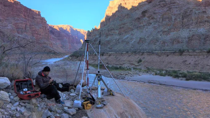
    Setting up the RTK GPS base station above the Colorado River, downstream of the rapids of Cataract Canyon. Photo by Chris Wilkowske, USGS
    451
  • user avatar
    USGS Water Resources
    US Department of the Interior
    @USGS_Water
    Jun 30
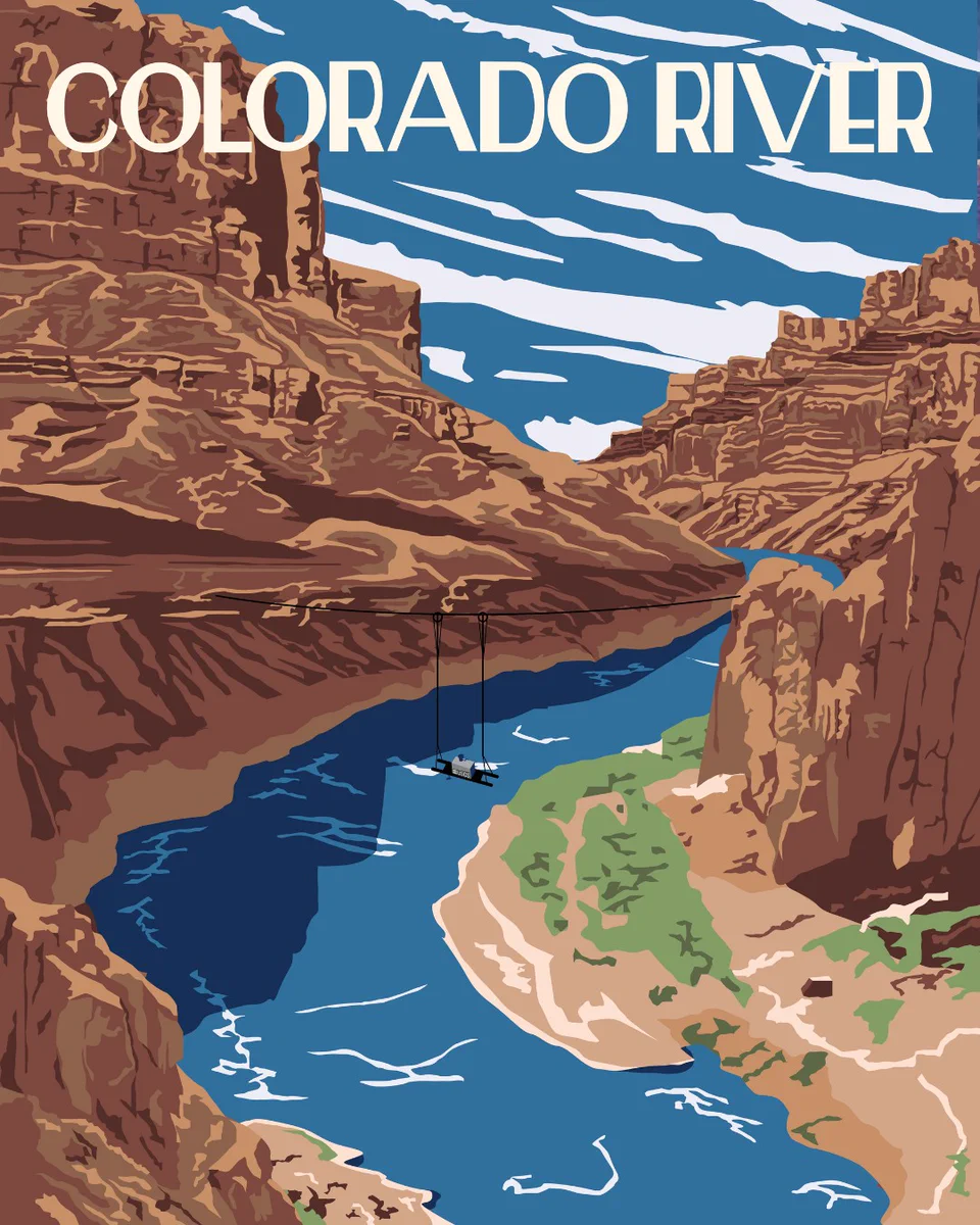
    Great American Waterway Day 2: The Colorado River! 🇺🇸 From the Rockies to the Gulf of California, the Colorado River is a lifeline for nearly 40 million people across the U.S. and Mexico. It supports major cities, farms, ecosystems, recreation, and hydropower across it’s
    Vintage-style poster of the Colorado River with a USGS water quality monitor portrayed on pulleys across the canyon. Illustration by Althea A. Archer, USGS
    367
Advertisement
Advertisement